ES Explore guides
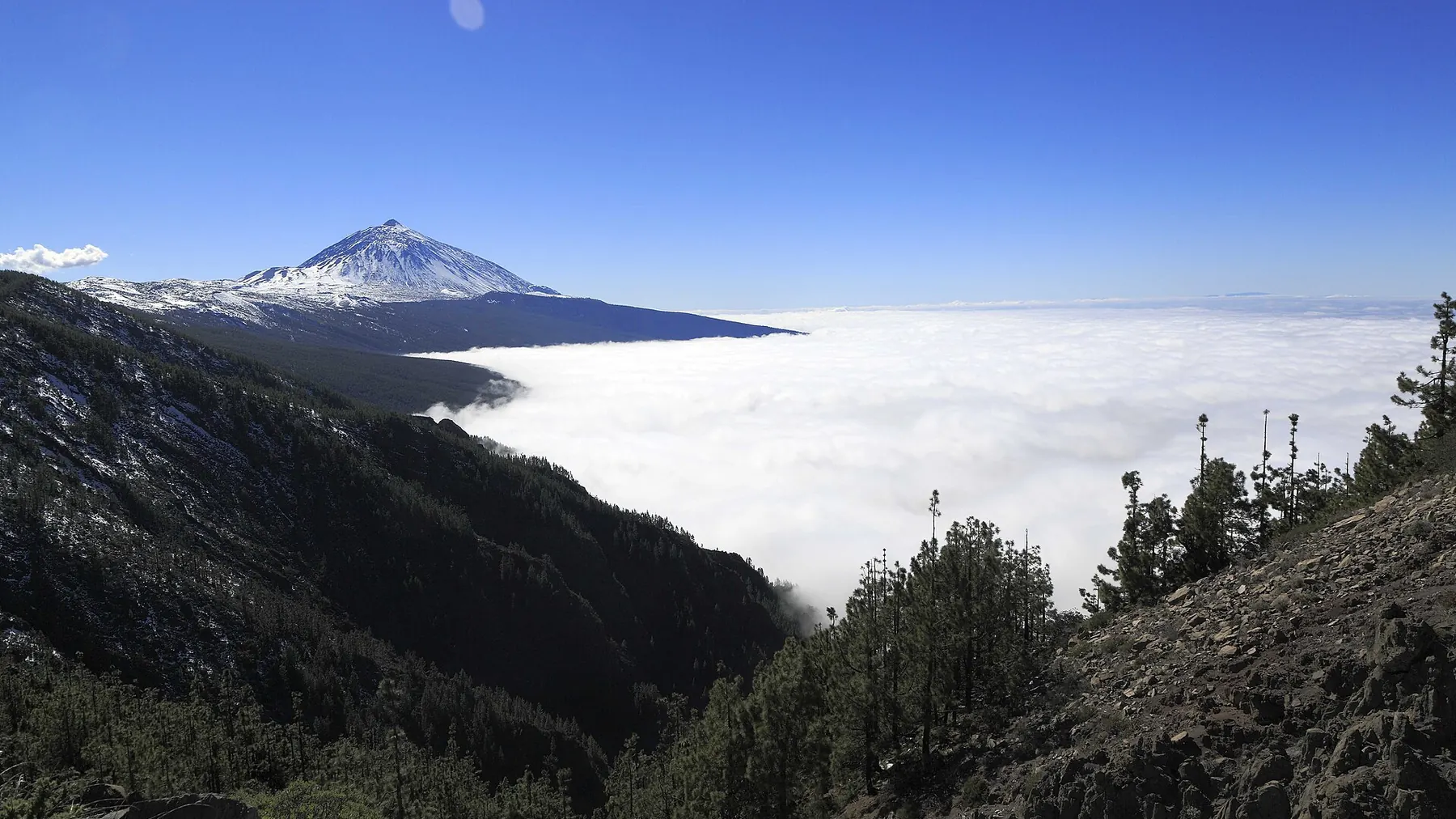
The Teide above a sea of clouds, seen from a viewpoint on the La Esperanza road (TF-24)

Viewpoints guide · Tenerife

Viewpoints in Tenerife: 25 lookouts over the island

The 25 viewpoints with an official Turismo de Tenerife listing, arranged by area: what you can see from each one, how to get there and what facilities they have. With a map, half-day routes and when to look for the sea of clouds.

25viewpoints with an official listing
5areas of the island
3 Nov 2026data checked

Quick answer

What they are and how to plan your visit.

A roadside viewpoint is a stop set up for looking. These are the ones in the official catalogue, and this is what their listings say.

What it is

A stop with a view

A viewpoint set up on the island's road network, with a railing and parking and often an information panel. This guide only includes those in the official Turismo de Tenerife catalogue.

Time

10–30 minutes each

Most people stop just long enough to look and take photos. A morning is enough for three or four if they are on the same road. This is our own estimate.

Getting there

By car, almost always

The listings show parking at 24 of the 25 and a bus stop at only 10. For most of them you will need a car.

Entry

No fee in the listings

The official listings do not mention an entry fee for any of them. Five have a café or restaurant (Cruz del Carmen, El Lance, La Garañona, San Pedro and La Cruz de Hilda).

Information checked on 3 November 2026. The data comes from the Turismo de Tenerife listings and may change: roadworks, road closures or cloud that hides everything. Check the state of the road and the weather before you go up.

How to choose

Pick by what you want to see.

You do not need to visit all 25. These are the clearest combinations according to the official listings; each name takes you to its entry.

I want to see the sea of clouds

The viewpoints on the La Esperanza road (TF-24) are the ones that tend to sit above the cloud layer. It is a variable phenomenon: check the forecast on the day.

I want to see the Teide

These viewpoints have it on the horizon if the day is clear, according to their official listings.

I want the capital and Anaga

Santa Cruz and La Laguna seen from above, with the Roques de Anaga in the background.

I want coast and cliffs

The ones that face the sea: the Acentejo coast, the Rambla de Castro, Garachico and Los Gigantes.

I want the La Orotava Valley

The classic postcard of the island, from the summit or from the coast of Los Realejos.

I'm going to Masca and Teno

The summit between Las Portelas and Masca, the Masca ravine and the Isla Baja.

Map

The 25 viewpoints on the island.

Each number links to its entry. Colours mark the area. Where several viewpoints are very close together, the marker is shifted slightly and a thin line shows the real position.

Catalogue

25 viewpoints, area by area.

Each entry summarises what you can see and the facilities given in the official listing. "Unconfirmed" means the data in the listing is not reliable.

Area
You can see

Viewpoints 1 to 5Anaga and La Laguna

The viewpoints of the Anaga massif and the La Laguna and Santa Cruz side: laurel forest, rock pinnacles and the capital at your feet. They are only a few minutes apart. If you are going to hike in the area, see also the Anaga guide.

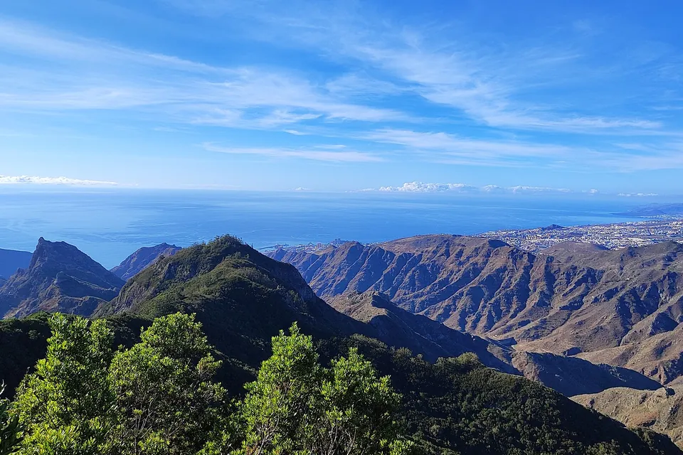
View from the Pico del Inglés viewpoint over the Anaga massif, Tenerife

Pico del Inglés

Santa Cruz de Tenerife

Cut into the rock itself, it is reached from La Laguna by the road up through the Las Mercedes forest. It takes in the north and centre of the island: the Roques de Anaga, Santa Cruz, La Laguna and, in the distance, the Teide. On one side you can see the Tahodio ravine with its dam and, behind you, the Afur ravine.

  • Parking
  • Bus stop
  • No adapted access
  • No information panel

It is one of the most visited viewpoints on the island and can be full, including with cyclists.

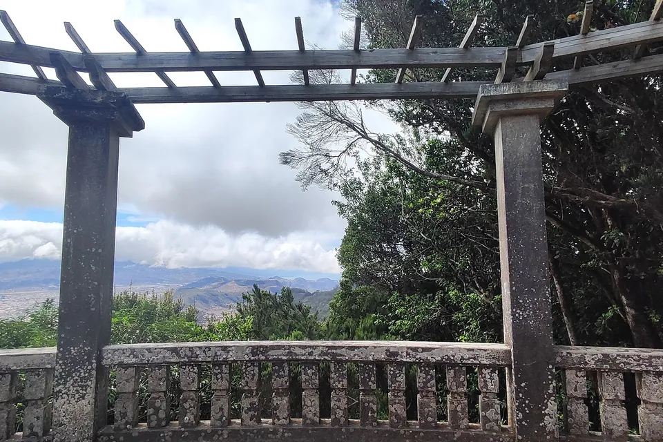
Pergola at the Cruz del Carmen viewpoint in Anaga Rural Park

Cruz del Carmen

San Cristóbal de La Laguna

In the heart of the laurel forest of Anaga Rural Park. It looks over the Vega Lagunera and the city of La Laguna, a UNESCO World Heritage Site, with the outline of the Teide in the distance.

  • Parking
  • No bus stop
  • Adapted access
  • Information panel
  • Restaurant, visitor centre and market

Its official listing gave a wrong coordinate (it landed 10 km away); we use the OpenStreetMap one.

Jardina

San Cristóbal de La Laguna

Right at the start of Anaga Rural Park, where the laurel forest begins. Views of La Laguna and, on clear days, the Teide, with farmland and small villages in between.

  • Parking
  • No bus stop
  • Adapted access
  • Information panel

Los Campitos

Santa Cruz de Tenerife

The capital at a glance: on the left the Anaga peaks, then the Muelle Norte and the Cabo Llanos district, with the Torres, the Auditorio and the Recinto Ferial. On clear days the view reaches the Malpaís de Güímar.

  • Parking
  • No bus stop
  • Adapted access
  • Information panel

El Boquerón

San Cristóbal de La Laguna

It overlooks the farmland of Valle Guerra, Tejina and Tegueste, the Anaga massif, the Roques del Boquerón and Punta del Hidalgo with its lighthouse. You can also pick out the recent volcanic cones of La Calderita and Valle Molina.

  • Parking
  • No bus stop
  • Adapted access
  • Information panel

Viewpoints 6 to 9The La Esperanza road (TF-24)

The climb to the Teide along the TF-24 from La Laguna and Tacoronte links four stops with the island at your feet. They are among the highest on the list and, on trade-wind days, they are usually above the cloud layer (more under sea of clouds).

Montaña Grande

El Rosario

A clearing among centuries-old pines on the climb along the TF-24 towards the Teide, with views of Santa Cruz, the farmland of El Rosario and the Anaga mountains. To the south you can make out the Malpaís de Güímar and even El Médano.

  • Parking
  • No bus stop
  • Adapted access
  • Information panel
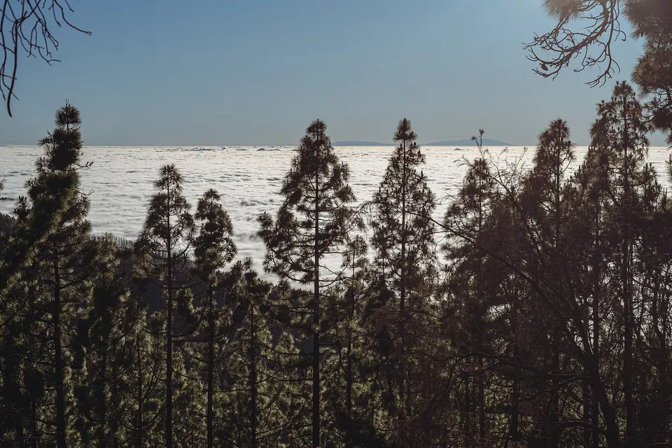
Pines and sea of clouds seen from the Ortuño viewpoint in La Victoria de Acentejo

Ortuño

La Victoria de Acentejo

A stone viewpoint just past kilometre 19 of the La Esperanza road. It gives the first views of the National Park and the north-west coast and, if the day is right, of La Palma and the sea of clouds.

  • Parking
  • Bus stop
  • Adapted access
  • Information panel

Cumbres del Norte (Chipeque)

Santa Úrsula

Above the La Orotava Valley: when the sea of clouds covers what lies below, you are left with its white blanket and, above it, the Teide, with the Teno massif behind and the outline of La Palma in the distance.

  • Parking
  • No bus stop
  • Adapted access
  • Information panel

Ayosa

La Orotava

At about 2,000 m above sea level, tucked among pines and high-mountain vegetation. You can see the La Orotava Valley, the head of the La Madre ravine, the pine forest above Aguamansa and, in the distance, the Teide above the Tigaiga slope and La Palma.

  • Parking
  • No bus stop
  • Adapted access
  • Information panel

Viewpoints 10 to 12Güímar Valley and Corona Forestal

Three balconies over the Güímar Valley and the pine forest of the south, between Arafo and Candelaria. They are somewhat off the busiest tourist circuit and combine well on one route.

La Crucita

Arafo

A natural balcony facing south-east on the TF-24, on the way to La Esperanza. It looks to the Pedro Gil caldera, with the Arafo volcano (last erupted in 1705), and to the Güímar Valley, often under the sea of clouds, with Gran Canaria in the distance.

  • Parking: unconfirmed
  • Bus stop: unconfirmed
  • Adapted access: unconfirmed
  • Information panel: unconfirmed

The official listing repeats here the access data and coordinates of Pico del Inglés. We corrected the coordinates with OpenStreetMap; we do not treat its parking, bus and accessibility data as reliable.

Montaña Colorada

Arafo

In the Corona Forestal Natural Park, facing south: views of Montaña Bermeja, the slopes of Arafo and the pine forest of the south, with a large car park.

  • Parking
  • Bus stop
  • Adapted access
  • Information panel

Chivisaya

Candelaria

Over the Güímar Valley, with its crops and greenhouses, and three protected areas in sight: the Malpaís de Güímar, the Siete Lomas Protected Landscape and the Corona Forestal Natural Park.

  • Parking
  • Bus stop
  • Adapted access
  • Information panel

Viewpoints 13 to 20Acentejo and the La Orotava Valley

The area with the most viewpoints on the list: from the town centre of El Sauzal to the cliffs of Los Realejos, via the most photographed valley on the island. For the town and its gardens, see the La Orotava guide.

La Garañona

El Sauzal

Almost inside the town of El Sauzal and well signposted from the centre. Views of the cliffs of the Acentejo coast and of Garañona beach, with a café-bar and terrace.

  • Parking
  • No bus stop
  • Adapted access
  • Information panel
  • Café-bar and terrace
Panorama of the La Orotava Valley from the Humboldt viewpoint

Humboldt

La Orotava

The whole La Orotava Valley: banana plantations, Puerto de la Cruz, La Orotava and Los Realejos, the volcanoes of El Fraile and Las Arenas and, above, the Teide.

  • Parking
  • No bus stop
  • Adapted access
  • Information panel

Mataznos

La Orotava

On the edge of an area of faya trees, heather, rockroses and strawberry trees, in the middle of the upper valley. It takes in everything from El Rincón to the Tigaiga slope, with the Teide.

  • Parking
  • Bus stop
  • Partly adapted access
  • Information panel

Piedra de la Rosa

La Orotava

Two viewpoints in one: one facing west, with views of the Teide and, on clear days, La Palma, and another across the road from which you can see a volcanic formation shaped like a rose. You reach it on foot through an underpass beneath the road; there is a small car park on the downhill side.

  • Parking
  • No bus stop
  • Partly adapted access
  • Information panel

La Corona

Los Realejos

One of the most spectacular on the island: you can see the whole La Orotava Valley and the fertile north-west. It is also a regular paragliding take-off point.

  • Parking
  • No bus stop
  • Partly adapted access
  • No information panel

El Lance

Los Realejos

On the road that drops from Icod el Alto to Los Realejos, with a café and terrace. Another view of the La Orotava Valley and its three municipalities. A bronze statue of the Guanche king (mencey) Bentor presides over the spot.

  • Parking
  • Bus stop
  • Adapted access
  • No information panel
  • Café and terrace

Its official listing had a coordinate with one digit missing; we corrected it and checked it with OpenStreetMap.

La Grimona

Los Realejos

At the exit of the TF-42 tunnel, heading towards Icod de los Vinos. Views of the coastline of Punta del Guindaste and of the basin from Acentejo to the Isla Baja, with Socorro beach and, in the distance, Puerto de la Cruz.

  • Parking
  • No bus stop
  • Partly adapted access
  • Information panel
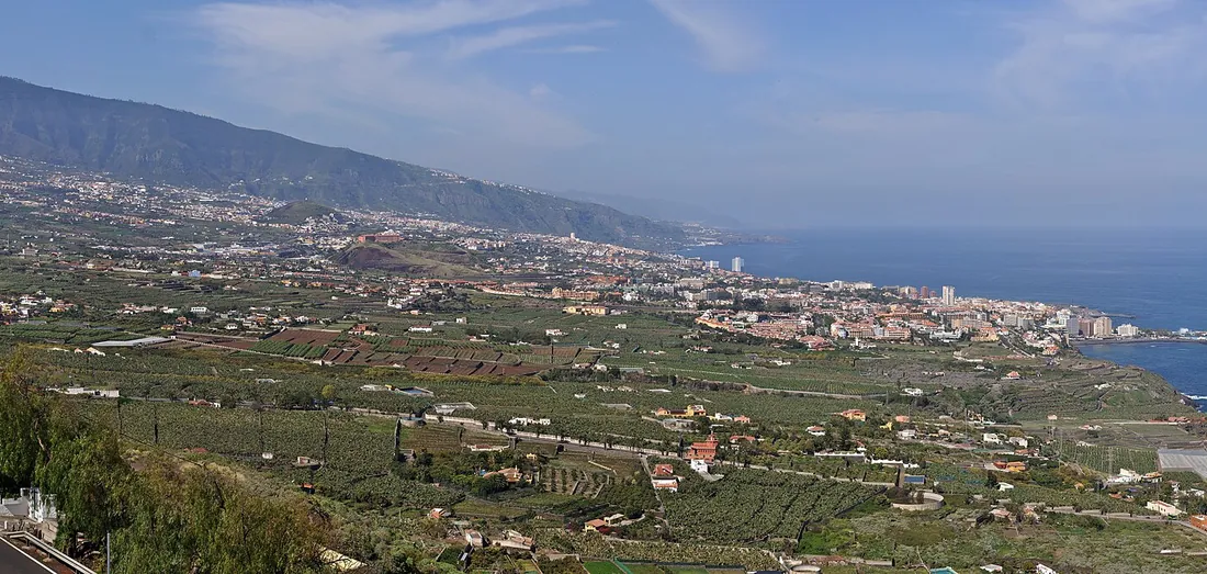
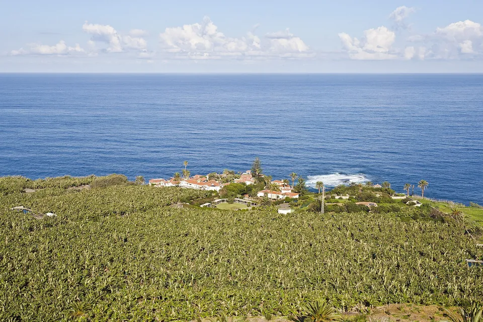
North coast and banana plantations seen from the San Pedro viewpoint in Los Realejos

San Pedro

Los Realejos

Over the north coast and the Rambla de Castro Protected Landscape: palms, banana plantations, the Hacienda de los Castro and the old La Gordejuela water lift. It has a restaurant and café.

  • Parking
  • Bus stop
  • Adapted access
  • Information panel
  • Restaurant and café

Viewpoints 21 to 25Isla Baja, Teno and the west coast

From the Roque de Garachico to the Los Gigantes cliffs, via the summit between Las Portelas and Masca. Before driving the TF-436, check the access restrictions in the Masca guide.

Lomo Molino

El Tanque

On the road between El Tanque and Tierra del Trigo. Views of La Caleta de Interián, the Roque de Garachico and the Isla Baja; on clear days, of the Teide and La Palma.

  • Parking
  • No bus stop
  • Adapted access
  • Information panel

El Guincho

Garachico

To the left, a panorama of Garachico and its rugged coast, with the Roque, the El Guincho cliff and the marina and fishing harbour. To the right, terraced fields that have since been abandoned.

  • Parking
  • Bus stop
  • Adapted access
  • Information panel

Altos de Baracán

Buenavista del Norte

At the summit of the road between Las Portelas and Masca, it lets you feel the change of climate between the north and south slopes: sometimes it is sunny on one side and drizzling a few metres away. You can see the Los Carrizales ravine and the El Palmar valley.

  • Parking
  • Bus stop
  • Partly adapted access
  • Information panel

Adapted access "only to some points", according to the listing.

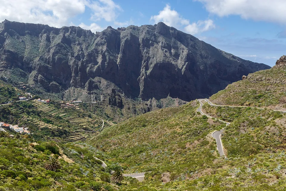
The Masca ravine and hamlet seen from the La Cruz de Hilda viewpoint

La Cruz de Hilda

Buenavista del Norte

A venue with a roof terrace, from which you can see the hamlet of Masca and its ravine, with terraces, palms and scrub all around. It has a café.

  • Parking
  • Bus stop
  • Adapted access
  • Information panel
  • Café with roof terrace

Archipenque

Santiago del Teide

On the descent to Puerto de Santiago. You can see the Los Gigantes cliff, the town with its marina and, to the right, the Punta de Teno lighthouse. According to the listing, the sunsets with La Gomera in the background are the highlight.

  • Parking
  • No bus stop
  • Adapted access
  • Information panel

We have left out the Mirador de La Centinela (San Miguel de Abona): it is still in the official catalogue, but the Cabildo awarded works to refurbish the building in February 2026. Nor do we include the observation points in Teide National Park, which have their own guide.

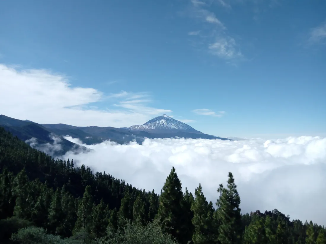
The Teide rising above a sea of clouds, with pines in the foreground

Best time

The sea of clouds: when and from where.

The trade wind brings humid air from the north-east, and a layer of dry air sits on top. At the boundary between the two, called the temperature inversion, a layer of stratocumulus forms that, seen from above, looks like a sea. It is described in a popular-science study by the meteorologist Luis Manuel Santana Pérez, published on Divulgameteo in 2020 (in Spanish).

According to that study, which uses data from observatories and weather stations on the island, the layer is thicker in winter (over 1,500 m thick on half the days between October and March) and thinner in summer (under 1,000 m in July and August). Summit stations at 1,630 and 1,745 m are above the layer on most days.

  • The summit viewpoints on the La Esperanza road are the best placed to see it from above.
  • Mid-slope ones can end up inside the cloud and see nothing; if it is clear below, the opposite can happen.
  • It does not form every day: check the forecast and, if you can, go in the morning.

Routes

Six routes for a morning.

Combinations of viewpoints on the same road. Times are driving time between stops, calculated with OpenStreetMap routes and a 30% margin for bends and traffic; they do not include the stops.

3 stops

Anaga in a morning

Three stops almost one after another inside Anaga Rural Park. Allow time to stroll around Cruz del Carmen. Anaga guide

  1. Jardina → 2.5 km · 3–4 min
  2. Cruz del Carmen → 2.0 km · 3–4 min
  3. Pico del Inglés

4.4 km · 6–7 min driving between stops

4 stops

The La Esperanza road

Four stops on the climb along the TF-24: from the pine clearing with views of the capital to the highest viewpoint on the list.

  1. Montaña Grande → 7.9 km · 8–10 min
  2. Ortuño → 7.1 km · 9–11 min
  3. Cumbres del Norte (Chipeque) → 2.8 km · 5–6 min
  4. Ayosa

17.8 km · 21–27 min driving between stops

3 stops

Güímar and the Corona Forestal

Three balconies over the Güímar Valley and the pine forest of the south.

  1. La Crucita → 8.1 km · 9–12 min
  2. Montaña Colorada → 6.8 km · 8–10 min
  3. Chivisaya

14.8 km · 17–21 min driving between stops

3 stops

The upper La Orotava Valley

From the valley's most famous viewpoint to the rose-shaped formation, climbing the TF-21.

  1. Humboldt → 12.0 km · 18–23 min
  2. Mataznos → 3.7 km · 4–6 min
  3. Piedra de la Rosa

15.7 km · 22–28 min driving between stops

4 stops

Los Realejos, from valley to coast

From the valley slope to the Rambla de Castro. It is the route with the most bends and the most driving time per kilometre.

  1. El Lance → 2.1 km · 7–9 min
  2. La Corona → 10.4 km · 18–24 min
  3. La Grimona → 3.7 km · 7–9 min
  4. San Pedro

16.2 km · 31–41 min driving between stops

Before you set off

Three things worth knowing.

General common-sense advice, not data from the listings. For the forecast, always use the official source.

Check the cloud before you climb

A mid-slope viewpoint can be inside the sea of clouds and show nothing. Check the AEMET forecast and, if in doubt, go up to a summit one.

Mountain roads

Many are on roads with bends (TF-24, TF-21, TF-12, TF-436). Park only in the designated spaces and do not stop on the carriageway. For the TF-436 check the access restrictions first.

Wrap up warm

At the summit ones it is cooler and can be windy even when it is hot on the coast. Bring a warm layer, especially at sunrise or sunset.

Comparison

Facilities at all 25 viewpoints, at a glance.

Data from the official listings. "Partial" covers cases where the listing says "with difficulty", "partial" or "only to some points". "Unconfirmed" is La Crucita, whose listing repeats data from another viewpoint. If you need a ramp, confirm before you go.

ViewpointAreaParkingBusAdapted accessPanelFacilities
1. Pico del InglésAnaga and La LagunaYesYesNoNo—
2. Cruz del CarmenAnaga and La LagunaYesNoYesYesRestaurant, visitor centre and market
3. JardinaAnaga and La LagunaYesNoYesYes—
4. Los CampitosAnaga and La LagunaYesNoYesYes—
5. El BoquerónAnaga and La LagunaYesNoYesYes—
6. Montaña GrandeThe La Esperanza road (TF-24)YesNoYesYes—
7. OrtuñoThe La Esperanza road (TF-24)YesYesYesYes—
8. Cumbres del Norte (Chipeque)The La Esperanza road (TF-24)YesNoYesYes—
9. AyosaThe La Esperanza road (TF-24)YesNoYesYes—
10. La CrucitaGüímar Valley and Corona ForestalUnconfirmedUnconfirmedUnconfirmedUnconfirmed—
11. Montaña ColoradaGüímar Valley and Corona ForestalYesYesYesYes—
12. ChivisayaGüímar Valley and Corona ForestalYesYesYesYes—
13. La GarañonaAcentejo and the La Orotava ValleyYesNoYesYesCafé-bar and terrace
14. HumboldtAcentejo and the La Orotava ValleyYesNoYesYes—
15. MataznosAcentejo and the La Orotava ValleyYesYesPartialYes—
16. Piedra de la RosaAcentejo and the La Orotava ValleyYesNoPartialYes—
17. La CoronaAcentejo and the La Orotava ValleyYesNoPartialNo—
18. El LanceAcentejo and the La Orotava ValleyYesYesYesNoCafé and terrace
19. La GrimonaAcentejo and the La Orotava ValleyYesNoPartialYes—
20. San PedroAcentejo and the La Orotava ValleyYesYesYesYesRestaurant and café
21. Lomo MolinoIsla Baja, Teno and the west coastYesNoYesYes—
22. El GuinchoIsla Baja, Teno and the west coastYesYesYesYes—
23. Altos de BaracánIsla Baja, Teno and the west coastYesYesPartialYes—
24. La Cruz de HildaIsla Baja, Teno and the west coastYesYesYesYesCafé with roof terrace
25. ArchipenqueIsla Baja, Teno and the west coastYesNoYesYes—

Frequently asked questions

What people ask most about the viewpoints.

The answers, with data from the sources checked on 3 November 2026.

What is the best viewpoint in Tenerife?

It depends on what you want to see. For the La Orotava Valley, Humboldt or La Corona; for Anaga and the capital, Pico del Inglés or Los Campitos; for the sea of clouds and the Teide, Ortuño, Chipeque or Ayosa; for cliffs, Archipenque or El Guincho. Above you have the guide to choosing.

Which viewpoints have views of the Teide?

According to the official listings, Pico del Inglés, Cruz del Carmen, Jardina, Humboldt, Chipeque, Ayosa, Mataznos, Piedra de la Rosa and Lomo Molino. Only if the day is clear: with cloud or haze (calima) it may not be visible. To go up the volcano, see the Teide guide.

Where can I see the sea of clouds?

The viewpoints on the La Esperanza road (Ortuño, Chipeque, Ayosa) and La Crucita are cited in their listings as places from which it can be seen. The sea of clouds is a layer of stratocumulus trapped by the trade wind under a temperature inversion, and it does not form every day, so there is no guarantee. More under sea of clouds.

Do I have to pay to enter the viewpoints?

The official listings for these 25 viewpoints do not mention any entry fee. Cruz del Carmen, El Lance, La Garañona, San Pedro and La Cruz de Hilda have a restaurant or café, which is separate.

How long do I need at each viewpoint?

Between 10 and 30 minutes is usually enough to look around and take photos; this is our own estimate. Cruz del Carmen deserves longer, because it has a visitor centre and trails. The routes group three or four stops per morning.

Can I reach the viewpoints by bus?

According to the listings, 10 of the 25 have a bus stop: El Guincho, El Lance, Altos de Baracán, Chivisaya, Mataznos, Montaña Colorada, Ortuño, Pico del Inglés, San Pedro and La Cruz de Hilda. Check lines and timetables on Titsa, as the listings do not give them.

Which viewpoints are wheelchair accessible?

The official listing marks adapted access at most of the viewpoints. It rules it out at Pico del Inglés and qualifies it at La Corona and La Grimona ("with difficulty"), Mataznos and Piedra de la Rosa ("partial") and Altos de Baracán ("only to some points"). This is Turismo de Tenerife data that we have not been able to check one by one: if you need a ramp, confirm first. The table is in the facilities comparison.

Where can I see Santa Cruz and La Laguna from above?

Santa Cruz, from Los Campitos, Pico del Inglés or Montaña Grande. La Laguna and its Vega, from Cruz del Carmen and Jardina. The cities themselves are in the La Laguna guide and the Santa Cruz guide.

Which viewpoint is best for sunset?

The official listing highlights the sunsets at Archipenque, with La Gomera in the background. For the rest there is no official data: it depends on where each viewpoint faces, and those facing west are the ones that get the sun as it goes down.

Why is the Mirador de La Centinela not included?

It is in the official catalogue (San Miguel de Abona), but in February 2026 the Cabildo awarded works to refurbish the building and bring it back into use, and the press described it as badly deteriorated. Until we can confirm that it can be visited, we leave it out. If that changes, we will update this.

What about the viewpoints in Teide National Park?

This guide covers the 25 viewpoints that have an entry in the official catalogue. The observation points in the National Park (Roques de García and others) are covered in the Teide guide and, for the night sky, in the stargazing guide.

Sources

Where the data comes from.

Information checked on 3 November 2026. We cite each source and mark what is not official.

Keep exploring the island

After the views, the water.

If you want more, see where to swim in the natural rock pools, the multi-day routes or the guided excursions.

Photo of the sea of clouds from the TF-24 (cover): Falk2, Wikimedia Commons (CC BY-SA 4.0) · Photo of Pico del Inglés: Mentxuwiki, Wikimedia Commons (CC BY-SA 4.0) · Photo of Cruz del Carmen: Mentxuwiki, Wikimedia Commons (CC BY-SA 4.0) · Photo of Ortuño: Flocci Nivis, Wikimedia Commons (CC BY 4.0) · Photo of Humboldt: Quartl, Wikimedia Commons (CC BY-SA 3.0) · Photo of San Pedro: Diego Delso, Wikimedia Commons (CC BY-SA 3.0) · Photo of La Cruz de Hilda: H. Zell, Wikimedia Commons (CC BY-SA 3.0) · Photo of the sea of clouds and the Teide: Miranda-forestal, Wikimedia Commons (CC BY-SA 4.0)