
In Los Gigantes
At the foot of the cliffs and right beside the Los Gigantes marina, in the municipality of Santiago del Teide, in the south-west of the island. Some listings also call it Argel.
Beach guide · Los Gigantes, Santiago del Teide
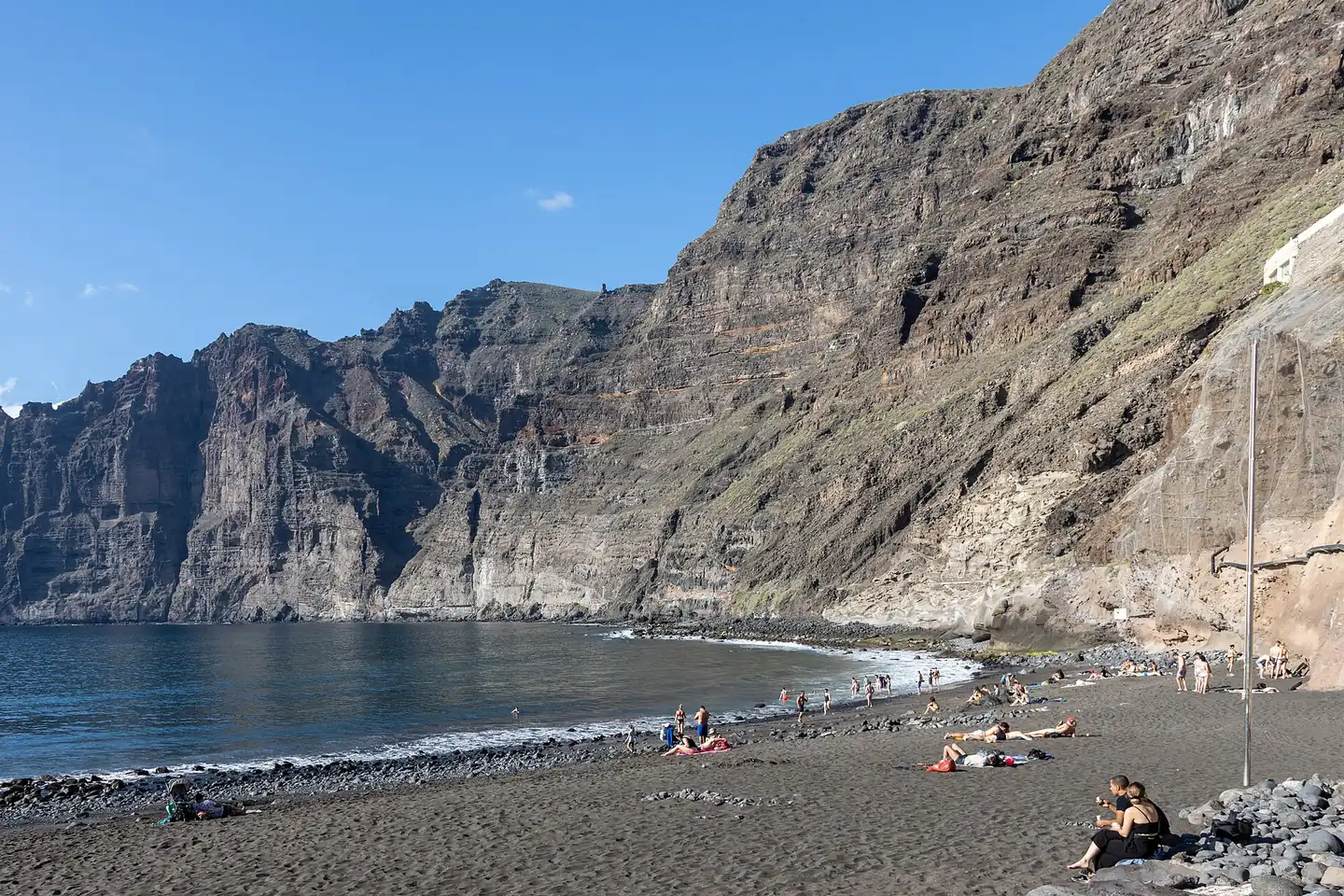
Playa de Los Guíos is the black-sand beach of Los Gigantes itself: about 180 metres right beside the marina, with the rock wall rising just behind. Here is how to get there, where to park, what facilities there are and when it is best to go.
Quick answer
This guide covers the beach only. The cliffs, the village and the boat trips are in the Los Gigantes guide; if you would rather have another option nearby, look at Playa de la Arena in the guide to Tenerife's beaches.
At the foot of the cliffs and right beside the Los Gigantes marina, in the municipality of Santiago del Teide, in the south-west of the island. Some listings also call it Argel.
With stones and pebbles on the seabed and along the shoreline. Water shoes are a good idea.
A small, urban beach, and the official listings rate its occupancy as high: in high season it fills up.
Official listings describe it as a calm-water beach, but this is open Atlantic coast: check the flag before you go in.
Showers, foot showers, toilets, sunbed and parasol hire, bins, cleaning and a lifeguard team; bars and restaurants a few steps away.
Enough for a swim. If you add a stroll around the marina and a meal, allow half a morning or half an afternoon.
Getting there
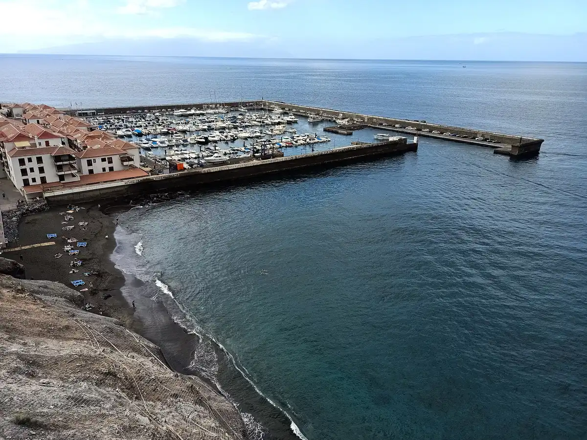
By car, by bus or from the marina itself. Either way you finish on foot along the marina's pedestrian street, because vehicles cannot reach the beach.
Where to park
The key is not to look for a space next to the sand: leave the car at the marina and walk a few minutes.
Official listings say the beach has no parking. The usual solution is to leave the car in the pay car parks at the marina and walk along the pedestrian street. According to the Los Gigantes guide, spaces next to the marina fill up by mid-morning in high season.
From the marina car parks it is 5 to 10 minutes' walk to the sand, depending on where you park. The car parks shown on OpenStreetMap are all pay car parks, along the two breakwaters and next to the marina buildings; they are marked P on the map below.
Access from the marina
The distance is measured on the OpenStreetMap map; the total time depends on where you park.
Sea and safety
Official listings classify the beach as calm-water. Even so, it sits on the open Atlantic coast, at the foot of walls of between 300 and 600 metres according to Turismo de Tenerife, and sea conditions change from one day to the next.
AEMET does not publish a forecast specifically for Los Guíos: the nearest beach forecast is for La Arena. Also check the coastal warnings before you set out.
Facilities
What the official listings record and what you can see on the ground. Prices, season and lifeguard hours are not in the listings.
Recorded in the official listings. According to OpenStreetMap, there is a free shower next to the beach access.
There are toilets beside the access promenade, according to the official listings and the OpenStreetMap map.
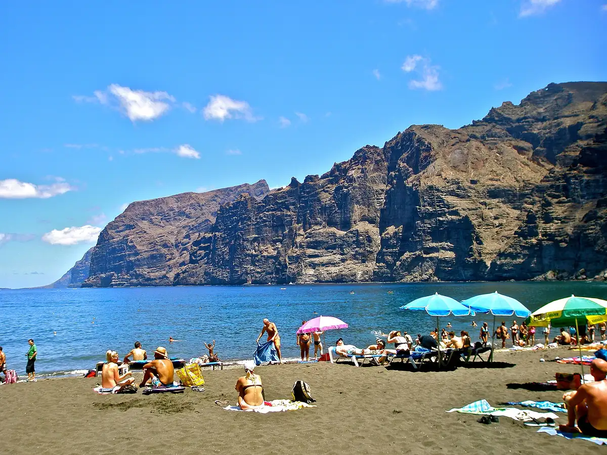
They are rented out on the beach, as is water-sports equipment. Prices are not in the official listings: ask before you settle in.
The Ministry's beach guide says it has a rescue team and danger signage. Check the post and the flag on the day you go.
There are bars and restaurants on Calle de los Guíos and along the marina promenade, and a restaurant with a terrace next to the beach access. The marina has most of the terraces, as the Los Gigantes guide explains.
The beach has a municipal cleaning service and bins. If you cannot see one nearby, take your rubbish with you.
Accessibility
The official sources do not agree. The Ministry for Ecological Transition's beach guide says the beach has access for people with reduced mobility, whereas Turismo de Tenerife does not list it as accessible.
If you travel with a wheelchair or have reduced mobility, confirm access with Santiago del Teide town council before you go.
When to go
Official listings give the beach a high occupancy, so the time of day matters more than the day. The time slots are our own recommendation, not hourly crowd data.
The Los Gigantes guide notes that the sea is usually calmer in the morning. It is when you find a sunbed and space. With the rock wall behind it, direct sun takes a while to reach the sand.
This is the busiest time for bathers, especially in August, at weekends and on public holidays. If you go now, expect to park far away and find a full beach.
Crowds thin out and you can stroll around the marina at your leisure. For sunset, head up to the Archipenque viewpoint in Puerto de Santiago, with views of the coast, the cliffs and, on clear days, La Gomera.
What to do nearby
Everything below is a few minutes away on foot or by car. Each one has its own guide for the detail.
A stroll beside the boats, terraces and shops, a step from the sand. It is the liveliest part of Los Gigantes.
They leave from the same marina: cruises to see the cliffs from the sea, with or without a swim. See excursions →
Pilot whales and bottlenose dolphins live in the channel towards La Gomera all year round. Dolphin and whale guide →
There is a viewpoint beside the beach access, with views of the sand, the marina and the cliffs, and the Archipenque viewpoint in Puerto de Santiago. West Tenerife guide →
The cliffs, the village and the marina, with everything to see and do. Los Gigantes guide →
About 3 km by road (8–10 minutes by car), in Puerto de Santiago, with road access as well. Beaches in Tenerife →
Have the whole day? From Los Gigantes you can also take the road to Masca and, further north, the lighthouse at Punta de Teno. Note that private cars cannot go up to Punta de Teno; according to Buenavista del Norte town council you get there by bus, by taxi or with authorisation. All of the west, with a map and routes, is in the west Tenerife guide.
Map
A schematic map with the beach, the marina, the pay car parks and the roughly 260-metre pedestrian walk that leads to the sand.
Frequently asked questions
The most common questions, answered with data from the official sources.
In Los Gigantes, in the municipality of Santiago del Teide, in the south-west of Tenerife. It is at the foot of the cliffs and right next to the Los Gigantes marina. Some listings also call it Argel.
You reach it on foot from the Los Gigantes marina along the pedestrian Calle de los Guíos: about 260 metres that end in a wooden walkway down to the sand. If you come by car, leave it in the marina car parks; by bus, Titsa routes 473 and 477 run to Los Gigantes.
The beach has no car park of its own. The usual option is the pay car parks at the marina, which fill up by mid-morning in high season. Parking on the village streets is often difficult.
Yes. It has black volcanic sand, with stones and pebbles on the seabed and along the shoreline, and it measures about 180 metres long by about 20 wide.
According to the official listings it has showers, foot showers and toilets, and the Ministry for Ecological Transition's beach guide says it has a rescue team. The lifeguard season and hours are not given in those listings: check the post and the flag on the day you go.
Yes. It is classed as a calm-water beach, but it is open Atlantic coast and sea conditions change from day to day. Check the flag, follow the lifeguards' instructions and wear water shoes because of the stones on the seabed.
The sources do not agree: the Ministry for Ecological Transition's beach guide says it has access for people with reduced mobility, whereas Turismo de Tenerife does not list it as accessible. Access is along a paved pedestrian street and a wooden walkway, and there is no car park of its own. Confirm the details with Santiago del Teide town council before you go.
Los Guíos is in Los Gigantes, next to the marina and at the foot of the cliffs, measures about 180 by 20 metres and is reached on foot from the marina. La Arena is in Puerto de Santiago, about 3 kilometres by road (8–10 minutes by car), measures about 140 by 40 metres and, according to Spain.info, has moderate waves and access on foot and by car.
The trips leave from the Los Gigantes marina, right next to the beach. Whale and dolphin watching departures and boat rides to see the cliffs from the sea set off from there.
One or two hours is enough for a swim. If you add a stroll around the marina and a meal, allow half a morning or half an afternoon. In the morning there are fewer people and the sea is usually calmer; midday is when there are most bathers.
Official sources
Reviewed on 4 October 2026. Official listings may change.
What is not in the official sources — lifeguard season and hours, car park rates and sunbed prices — is not included here. The time slots and the recommended time are our own estimates.
Next stop
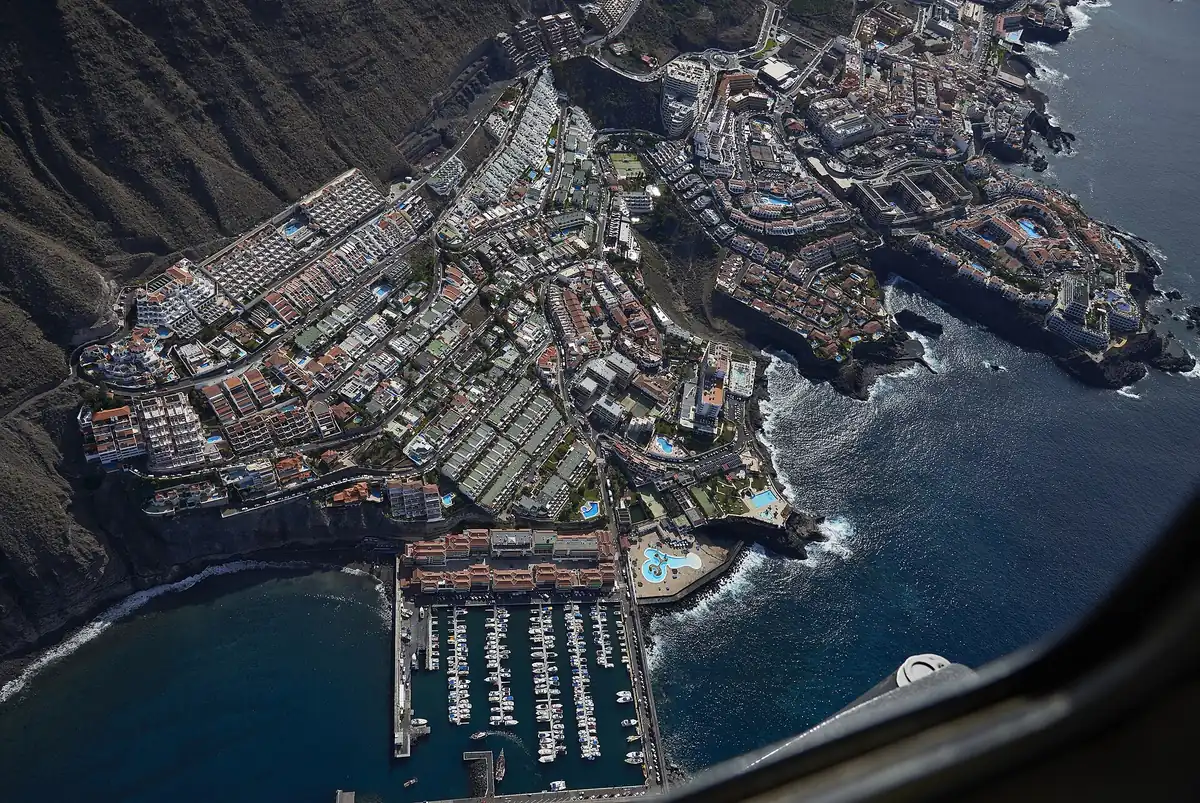
Playa de Los Guíos is the gateway to Los Gigantes: from its marina leave the boats that sail up to the base of the wall and out to the dolphins.
Photo of the beach: Mike Peel, Wikimedia Commons (CC BY-SA 4.0) · Photo of the sunbeds: X3m, Wikimedia Commons (CC BY-SA 3.0) · Photo of the beach next to the marina: G.Lanting, Wikimedia Commons (CC BY 4.0) · Photo of the aerial view: Wouter Hagens, Wikimedia Commons (CC BY-SA 4.0) · Map: © OpenStreetMap contributors (ODbL)