
ES Explore guides
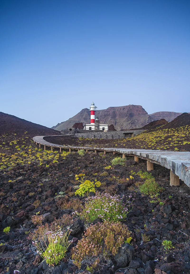
Punta de Teno lighthouse at sunset

Places guide · The western tip of Tenerife

Punta de Teno: the end of the road, the beginning of the Atlantic

A lone lighthouse, a vertigo-inducing road carved into the cliff and a black-sand beach at the point where the Teno Massif surrenders to the ocean — the island's westernmost and least tamed corner.

Western tipTenerife's westernmost point
1897Year the lighthouse was built
Half a dayRecommended time
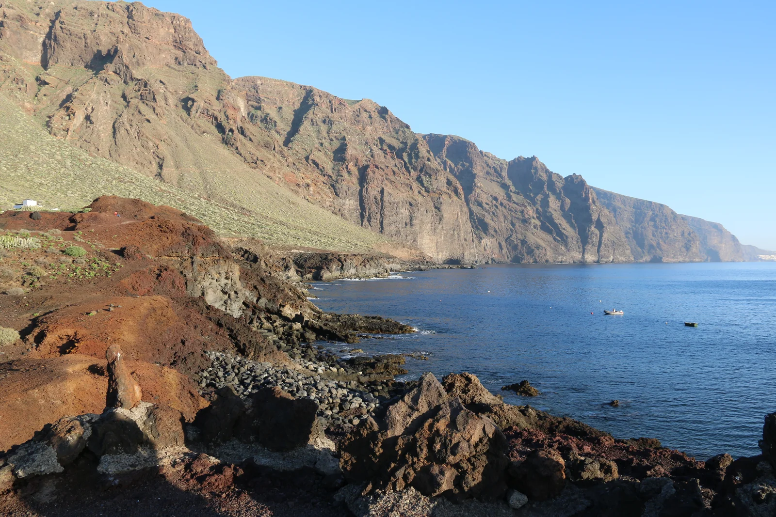
Coast of the Teno Massif

Why it is worth the visit

The corner the island left untamed.

The Teno Massif is, along with Anaga, one of Tenerife's oldest volcanic formations: some six million years of erosion have left an arid landscape of sheer cliffs and deep ravines, very different from the green of Anaga or the gentle profile of the south. Punta de Teno is its tip, the exact point where the massif ends and the Atlantic begins.

Getting here is already part of the experience: the TF-445 road runs along the cliff edge from Buenavista del Norte in a layout of sharp bends that ranks among the most spectacular — and most regulated — on the island.

What to see

Three kilometres of cliff, a single destination.

Everything at Punta de Teno fits into a short afternoon.

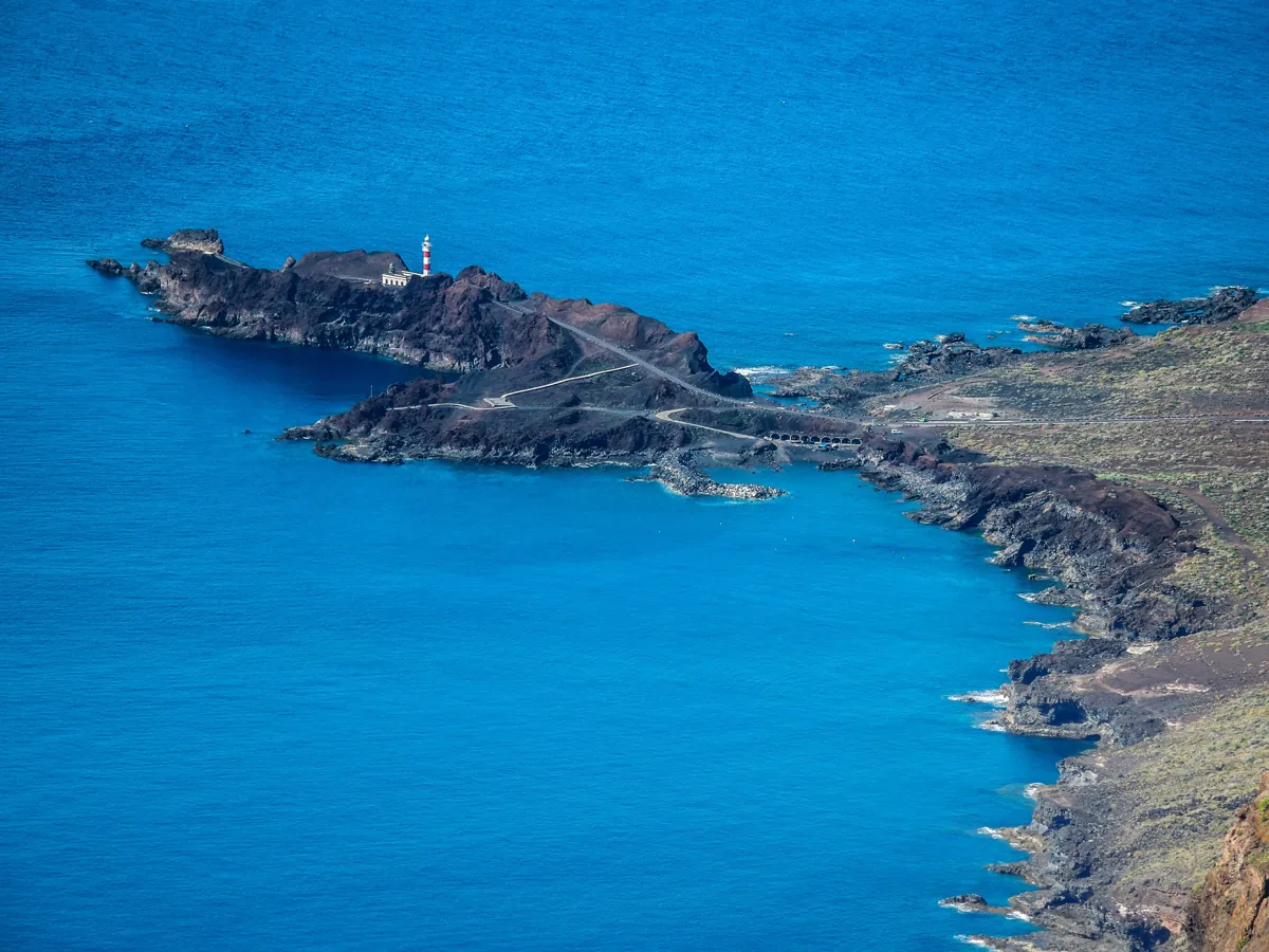
01Punta de Teno lighthouse

The Teno lighthouse

Built in 1897, it marks the point where the road ends and where the Teno Massif drops straight into the Atlantic. From its base, on clear days, you can make out the silhouette of La Gomera on the horizon.

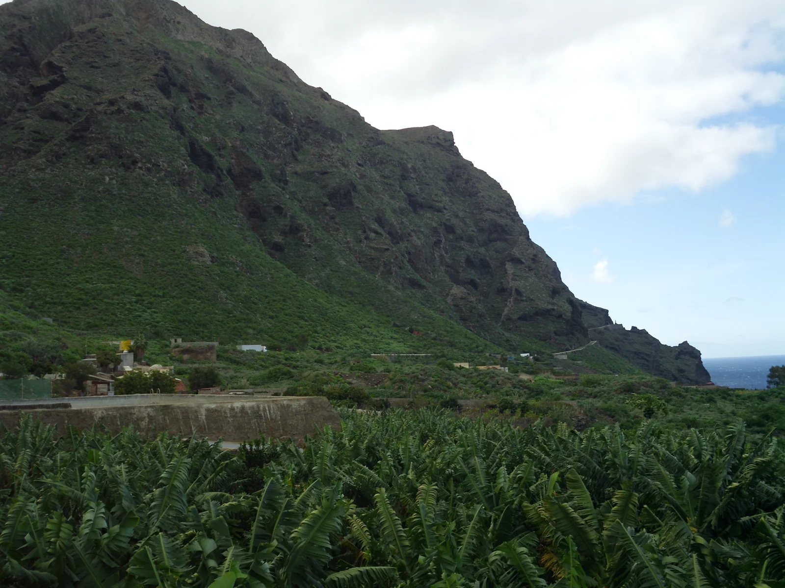
02The TF-445 road to Punta de Teno

The TF-445 road

Thirteen kilometres that cross ravines and terraced banana plantations before climbing the slope of the Teno Massif to the lighthouse — narrow, winding, with the sea appearing between bends. Buenavista del Norte is left behind; what follows is just rock, crops and ocean.

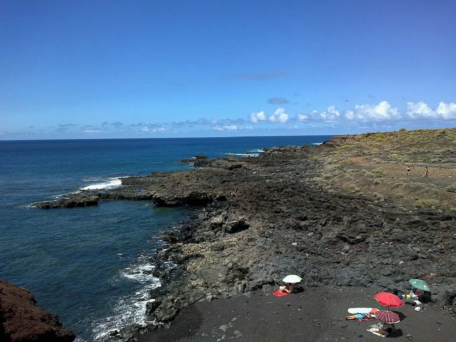
03Playa de los Roques de Teno

Playa de los Roques de Teno

A strip of black sand and pebbles next to the lighthouse, with the massif falling almost vertically into the water. It isn't a beach for swimming — the surf is usually strong — but it is one of the most photogenic and least crowded corners of the north coast.

How to organise it

How to reach the end of the road.

Private cars can't go up: you get there by bus, taxi or boat.

01 · BY CAR (NOT ALLOWED)

Private cars can't go up

According to the Buenavista del Norte town council, access to the TF-445 by private vehicle, on foot or by bicycle is prohibited every day. Only buses, taxis and some authorised vehicles may enter.

  • Check the current status before you go
  • Narrow road, with one-way stretches
  • Park in Buenavista del Norte and take the bus
02 · BY BUS

The bus from Buenavista

Titsa's line 369 leaves from Buenavista del Norte bus station and takes about 20 minutes (1 euro per journey). According to the council, it runs from 10:00 to 19:00 from 1 October to 20 June and from 8:00 to 20:00 from 21 June to 30 September.

  • Departs from the centre of Buenavista del Norte
  • The usual way to get there
  • Check up-to-date timetables before you go
03 · BY BOAT

From the sea, with Los Gigantes

Several catamaran excursions leaving from Los Gigantes and Puerto de Santiago skirt the Teno coast and approach the lighthouse from the water — the same route as many whale-watching trips.

  • Departs from Los Gigantes or Puerto de Santiago
  • Views of the cliff from the sea
  • Combined with whale watching

Before you go

You can't drive up in a private car.

A narrow, fragile road, regulated every day.

Important

According to the Buenavista del Norte town council (access to Punta de Teno, in Spanish), access by private vehicle, on foot or by bicycle is prohibited every day because it is an especially fragile area. You get there on bus 369 from Buenavista del Norte, by taxi or on a boat trip. Conditions can change because of roadworks or the weather: check the current status before you set out.

Practical information

How to get there and when to go.

At the northwestern tip of the island, twenty minutes from Buenavista del Norte.

GETTING THERE

TF-445 from Buenavista

The access road leaves from the centre of Buenavista del Norte and runs along the cliff to the lighthouse.

Teno Massif
ACCESS BY CAR

Not allowed

Private cars can't go up; bus 369 leaves from Buenavista del Norte (1 euro, about 20 minutes).

BEST TIME

Sunset

The point faces west: one of the clearest sunsets on the island, with La Gomera in the background.

WHAT TO BRING

No facilities at the point

There are no bars, restaurants or shops next to the lighthouse: bring water and something to eat, and save your meal for Buenavista del Norte, before or after.

HOW LONG

Half a day

Enough for the lighthouse, the beach and the drive along the road.

Access road to Punta de Teno
WILDLIFE

Free-roaming goats

It is common to meet wild goats on the final stretch of the road; slow down, especially on the bends.

WHAT TO COMBINE

Masca and Los Gigantes

The same northwestern corner of the island — easy to combine on a one-day route.

ALSO NEARBY

Teno Rural Park

Hiking routes through the massif, with viewpoints over the ravine and the coast. All of the west, in the guide to western Tenerife.

Before you set off

Common mistakes to avoid.

Cliffs of the Teno Massif
  • Check the current access status and the bus timetable before you set out — they can change.
  • Bus 369 is the usual way to get there; check up-to-date timetables with Titsa.
  • The TF-445 road is narrow with sharp bends: drive slowly and avoid overtaking.
  • The surf at Playa de los Roques is usually strong — it is not a beach for swimming.
  • Go at sunset if you can: the point faces west and the horizon is usually clear.

Frequently asked questions

The essentials before visiting Punta de Teno.

Why is car access to Punta de Teno restricted?

According to the Buenavista del Norte town council, because it is an especially fragile area: access by private vehicle, on foot or by bicycle is prohibited every day and only bus 369, taxis and authorised vehicles may go up.

How do you get there if you can't go by car?

Titsa runs a bus from the centre of Buenavista del Norte to Punta de Teno that doesn't depend on private-traffic restrictions.

Can you go by boat?

Yes. Several catamaran excursions leaving from Los Gigantes or Puerto de Santiago skirt the coast of the Teno Massif and approach the lighthouse from the sea.

Is it worth going to see the sunset?

Yes — as the westernmost point of Tenerife, it offers one of the clearest horizons on the island for watching the sun go down, with the silhouette of La Gomera in the background.

Are there restaurants at Punta de Teno?

No, there are no bars or restaurants next to the lighthouse. The option is to eat in Buenavista del Norte, before going up or on the way down, or to bring a picnic.

Is it normal to see goats on the road?

Yes, the Teno Massif has a population of wild goats and it is common to meet them on the final stretch of the TF-445 — it is best to slow down on the bends.

Volcanic coast of Punta de Teno

Next stop

The same cliff, seen from another shore.

Punta de Teno is the tip of a massif that still defines the whole northwest coast. Los Gigantes, with its cliffs above the same ocean, is the natural stop for exploring this corner of the island further.

Photo of the lighthouse: Yonathan Tabaibo, Wikimedia Commons (CC BY-SA 3.0 ES) · Photo of the access road: Jan Pešula, Wikimedia Commons (Public domain) · Photo of Playa de los Roques: rene boulay, Wikimedia Commons (CC BY-SA 3.0) · Photo of the massif: FrDr, Wikimedia Commons (CC BY 4.0)